US

United States


514 ha

King County Parks

Improved Forest Management

From planned residential developments to public parks on the outskirts of Seattle

Overview

King County Parks

US

United States


514 ha


Developer: King County Department of Natural Resources, Water and Land Resources Division

Improved Forest Management

The King County Forest Carbon Program supports the permanent protection of threatened forests in both rural and more suburban parts of the county across a set of dispersed properties including some islands in Puget Sound. As of 2020, the project has acquired 96 parcels totaling 514 hectares and will continue to add more as the project progresses. Run by the King County Department of Natural Resources and Parks (DNRP), this project is using carbon financing to accelerate the purchase of additional parcels of land that are at risk of clearing for rural residential development or commercial timber harvest.

Connect with our team to learn more about this project and how Pachama can support your nature strategy.

Registry

Verra Logo

Registry ID: 1911

Methodology

VM0012

Pachama's project evaluation criteriaPachama rigorously evaluates every project listed on our marketplace to ensure that we're surfacing only the highest quality projects. Our Evaluation Criteria includes a series of checks that every project must pass as well as a number of informative insights on project quality. You can see a preview of these checks below.

01

Additional

Does the project have a net additional climate benefit?

  • Net additional climate benefit

    Emissions reductions are calculated based on the difference between baseline, project, and leakage emissions. Pachama analyzes emissions claims to confirm that the project has a net additional climate benefit, and each credit represents at least one metric ton of carbon.

02

Conservative

Is the climate benefit based on sound and conservative claims?

  • Baseline claims

    Pachama analyzes baseline emissions accounting to confirm that the reported baseline emissions are less than what Pachama observes with remote sensing.

  • Project claims

    Pachama assesses the project boundary, project emissions accounting, carbon inventory, and financial and legal additionality.

  • Leakage claims

    Pachama summarizes the project's reported leakage emissions accounting.

03

Durable

Is the climate benefit long-lasting?

  • Ongoing monitoring

    Pachama quantifies emissions since the last verification to ensure the project continues to deliver a climate benefit.

  • Project risks

    Pachama characterizes fire and other natural risks and summarizes buffer pool contributions.

04

Beyond Carbon

Does the project deliver benefits beyond carbon?

  • Social impacts

    If a project occurs on community-owned land, Pachama confirms the community is fully informed of the project activity and impact, consent is given without coercion, and a grievance and redress mechanism is in place.

  • Ecological impacts

    For ARR projects, Pachama analyzes native species planting, species diversity, regional suitability, and reforestation practices.

  • Certifications

    Pachama provides a summary of the project's awarded certifications.

1/4


Tech-verified evaluationEvery forest project listed on the Pachama Marketplace must align with our Evaluation Criteria to ensure we're surfacing only the highest quality projects. To assess a forest project, Pachama uses remote sensing to review a variety of factors including forest cover loss in and around the project area. This project passes our emissions quality checks because the reported emissions are in line with what Pachama observed.

Contains modified data from Hansen Global Forest Change v1.9 (2001-2021).

Visual Description

The figure above shows the project area outlined in white, and observed forest loss in red. The project has been active since 2015. Pachama analyzes forest loss data and removes false positives during our project evaluation process.

Project story
Providing clean air, water, and public parks by protecting existing forests

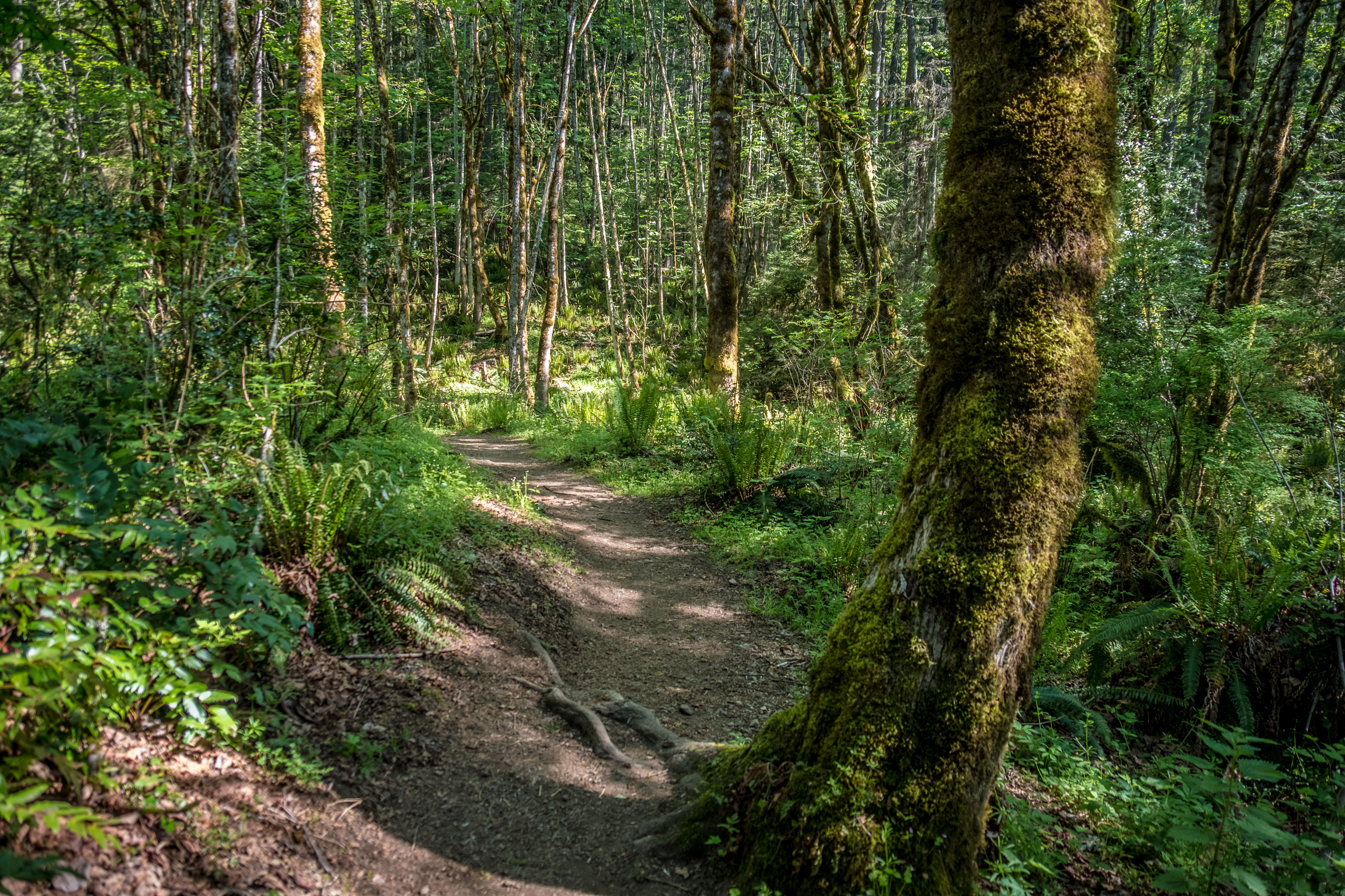
Located near Seattle, Washington in the Pacific Northwest, this area is known for its temperate rainforests that include some of the largest trees in the world, yet is also the most populous county in the state with over 2.23 million residents. Most forests in King County have been heavily cut for timber production and regenerated one or more times since the late 1800s. Additionally, over the past several decades, increased local housing demand has expanded into rural areas putting pressure on nearby forests. By conserving these forests, the project will not only provide net emissions reductions but also protect biodiversity, water quality, and other ecosystem services.

The King County Rural Forest Carbon Project is a Grouped Project including multiple properties. All acquired properties will be managed for conservation, including enhancing carbon storage, maintaining or improving fish and wildlife habitat, recreation, and with certain properties maintaining activities like selective thinning to enhance forest health and resilience.

65,966

tons of net CO2 emissions will be reduced over the project’s first 10 years (12.82 tons per hectare per year).


100

year crediting period, started on Jan. 1 2015.
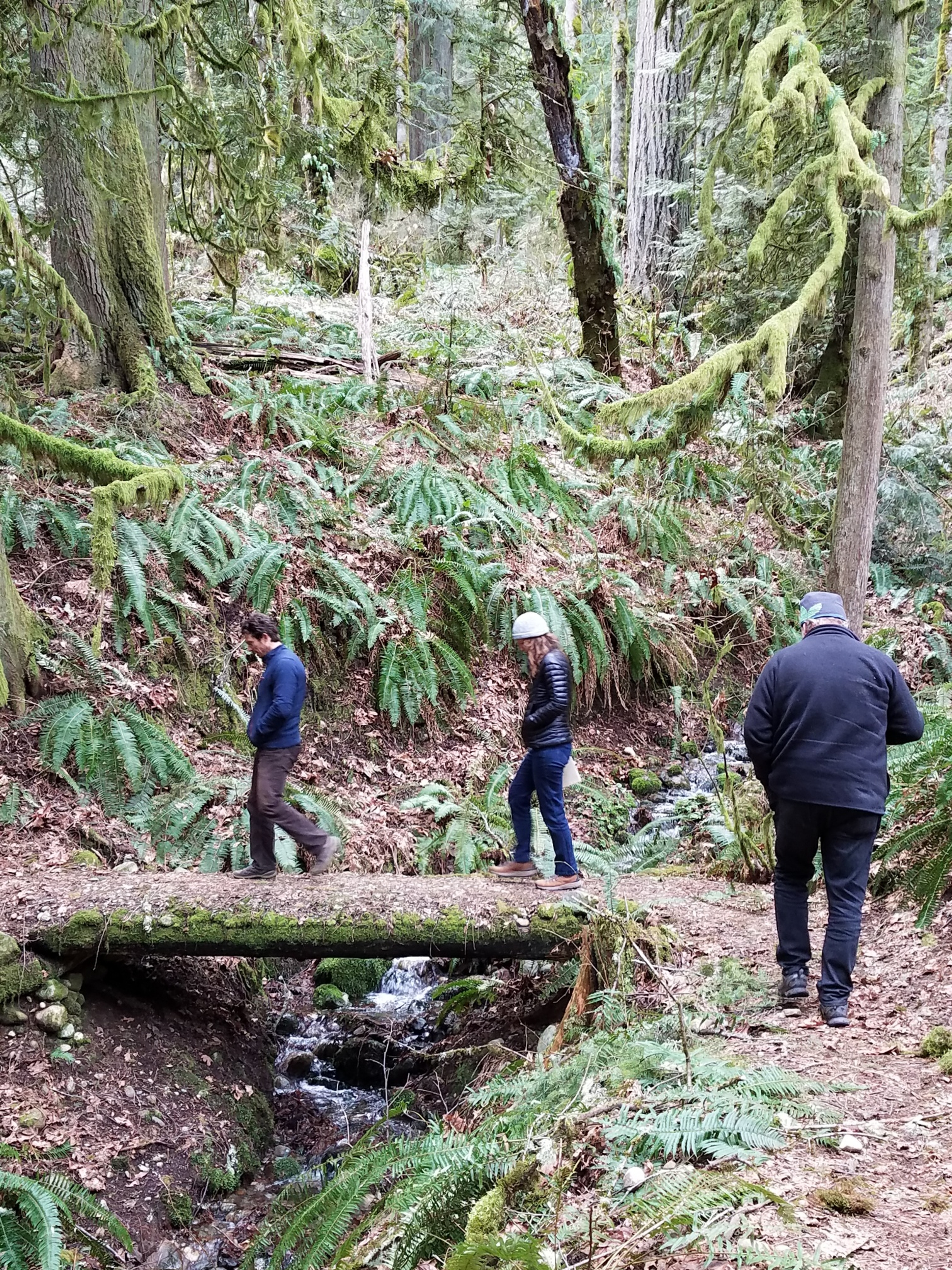
King County staff leading a tour in  Cougar Mountain Regional Wildland Park.

King County staff leading a tour in Cougar Mountain Regional Wildland Park.
Impacts beyond carbon

Climate benefits and healthy communities

All of the properties included in the project are open for public use, expanding access to forested green space and providing physical and mental health benefits to the county’s residents. There is significant local support for additional parks, green space, and conservation in the rapidly developing area surrounding Seattle. Learn more about a few of their key initiatives:

11

Sustainable cities and communities

Acquiring properties for the King County Parks system, which provides employment opportunities, youth job training, education programming, and recreational access development.

13

Climate action

Protecting remaining high conservation value lands and securing a regional trail network within 30 years with The King County Land Conservation Initiative.

06

Clean water and sanitation

Protecting and restoring habitats in order to preserve and enhance the well-being of 2.25 million residents, fulfill tribal treaty rights, eliminate inequities, and recover threatened salmon and orca through the Clean Water Healthy Habitat Strategic Plan.

biodiversity
Sustaining habitat for salmon and other wildlife

Protecting these forests saves critical salmon habitat and preserves corridors for Washington State’s remaining elk, bears, and other wildlife in an increasingly fragmented and paved-over landscape. By maintaining forests on the landscape, the project also improves water quality and quantity throughout the county in parallel with improved air quality.

biodiversity image
Western Red-Cedar image
tree spotlight
Western Red-Cedar

Native to the West Coast of the U.S., the western red cedar grows up to 300 feet tall, especially in moist, cool, or fertile areas, and can often live to 1,000 years old if undisturbed. It is one of the most culturally important species for Tribes in the Pacific Northwest, with high conservation value.

how this project helps

This project protects intact forests, including areas where western red-cedar is well-established. In cases where acquired forests have a low diversity of tree species, western red-cedar is one of the species planted.

Salmon image
animal spotlight
Salmon

Salmon populations in the Puget Sound region have sustained Indigenous communities and played a key role in natural ecosystems for millennia. Puget Sound is home to five species of salmon including Pink, Chum, Chinook, and Coho, but habitat degradation and loss, along with overfishing, have led to sharp declines since the late 1800s. Degradation of riparian forests and loss of forest cover have altered in-stream conditions and have contributed to these declines.

how this project helps

Healthy riparian and upland forests protect salmon habitat. This project protects high-priority forestland, contributing to shading in riparian areas and keeping stream temperatures lower, while also protecting upland forests that provide water quality and quantity benefits essential for salmon.

Public registry documentsApplicable calculation methods are referenced in the reports below. Note that registries do not publicly provide all pertinent data required to reproduce emissions calculations. However, Independent Validation and Verification Bodies have access to the data needed to reproduce and verify emissions calculations.
  • Monitoring Report 2019-2020

    pdf

  • Project Description Document

    pdf

  • Verification Report 2019-2020

    pdf

  • Verification Report 2015-2018

    pdf

  • Validation Report

    pdf

  • Monitoring Report 2015-2018

    pdf